TRIP SNIP: Mahurangi - Te Muri Bay, Thursday 29th August 2019.
Mahurangi Regional Park is a collection of coastal park locations that define the entrance into Mahurangi Harbour totalling 245 hectares. The Park consists of three distinct areas with two coastal peninsulas that contain a range of sheltered sandy Bays backed by bush covered cliffs and overlooking the scenic Mahurangi Harbour. The park is made up of:
a) Mahurangi West; consisting of Tungutu Point overlooking the sheltered popular sandy Sullivans Bay(Otarawao) and the secluded Mita Bay (Otuwao) to the North, and Cudlip overlooking the Te Muri -o- Taraiki Stream to the South, and Te Muri Regional Park
b) Scott Point, lying at the end of the bush covered Te Kapa peninsula in the Mahurangi Harbour, contains two bachs and the historic Scott Homestead.
c) Mahurangi East, which is isolated on the eastern peninsular, separated by the Te Kaka river estuary and the Mahurangi Harbour, is accessible only by boat. It contains two baches, one on the west side of the peninsular fronting the tidal Lagoon Bay ( Vine House) and one on the eastern side in the secluded and sandy Big Bay.
The sea Captain, John Sullivan born in London in 1810, settled at Otarawao (Sullivans Bay) in 1844 and married Merehai Kaipaka, possibly of the family Makoare Ponui. From 1842 till his death in 1883 he was the owner and skipper of a number of coastal trading ships. His descendants farmed the land for nearly a century and built the Historic Sullivan Homestead in 1875.
Mahurangi Regional Park was acquired for regional purposes from 1966. The park was developed in the late 1970's.
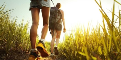
Well what a day, 26 of us drove to Sullivan's Bay on this glorious warm sunny day. Many of us had been there before but still we were to find different parts of the park that we had not been to. We started off heading over to Mita bay where we had great views on Tungutu Point overlooking the Bay, surrounded by new born lambs. We steadily climbed up from Sullivan's Bay, then on down to Mita where we stopped for morning tea in the sun.
From here we were able to go around the rocks back to Sullivan's Bay along the beach and continue around Cudlip point, across Te Muri Estuary and along the lovely Te Muri Beach.
(With the purchase of the 383-hectare farm behind Te Muri, in 2010, fresh plans were made for road access and massed car parking at the beach. But rather than the road crossing the Puhoi Estuary, it was to follow the scenic ridge and render it useless as the obvious terrestrail route for Te Araroa, the national walkway - currently the majority of Te Araroa walkers are forced to struggle along the shoulder of State Highway 17 between Puhoi and Wenderholm. Thank goodness the carpark didn't go ahead.)
From here we walked around the point to Puhoi Cottage situated on the side of the Puhoi River Mouth overlooking the river and Wenderholm where we stopped for lunch. Without access to Mains power the Puhoi cottage sits unused throughout the winter on account of it's reliance on solar power. A lot of laughter was had over lunch as one of our WOPpers recounted her night out at a production, I will not go into the conversation but it made for an interesting lunch stop enjoyed by all.
After lunch we walked alongside the river then a steep climb to the top overlooking Te Muri Bay, Linda then took us into a lovely piece of bush before descending down a steep fenceline to Te Muri beach and campground. Back over the Te Muri Estuary on up the very steep hill to the top of the entrance to Sullivans Bay and back to the cars.
A very enjoyable day had by all with lots of laughter and catching up of friends, thanks Linda for a most enjoyable day.
Does anyone know where to write our submissions to open up more of the access at Te Muri bay for walking purposes?
Cheers Carol W
Click here for photos from Carol, Deborah G and Alison K